Aerial image annotation is transforming traffic flow and infrastructure with real-time data and powerful analysis.
Introduction:
Ever felt stuck in traffic, wondering if anyone’s actually looking at the big picture? It’s frustrating, right? What if there was a way to see the entire traffic network, in real-time, and make better decisions? That’s where aerial image annotation comes in. It’s like having a bird’s-eye view of the roads, allowing us to pinpoint problems, optimize flow, and even prevent accidents before they happen. Let’s explore how this technology is changing the way we manage traffic.
Challenges in Traditional Traffic Management:
Effective traffic management is crucial for the smooth functioning of any city. However, traditional traffic management systems often struggle to keep pace with the demands of modern transportation networks. These systems heavily rely on outdated technologies, leading to several significant challenges.
One of the primary limitations is the inefficient use of resources. Traditional methods often involve manual data collection and analysis, which is time-consuming and labor-intensive. This reliance on human input can lead to inaccuracies and delays in responding to traffic incidents. Moreover, traditional systems often lack real-time visibility into traffic conditions. Without a clear understanding of current traffic patterns, authorities struggle to make informed decisions about traffic signal timing, incident response, and road maintenance.
The inability to accurately predict and manage traffic flow results in increased congestion, longer commute times, and frustration for drivers. This lack of real-time information also hinders emergency services, as they may be caught off guard by unexpected traffic jams.
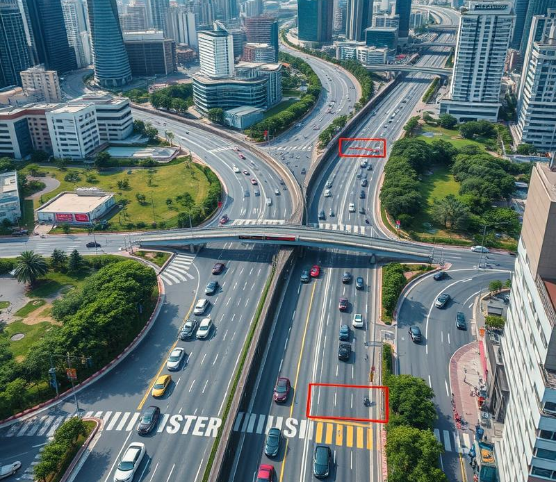
The Role of Aerial Image Annotation in Traffic Management:
Addressing the shortcomings of traditional traffic management systems requires innovative solutions. One such solution that is rapidly gaining traction is the use of aerial image annotation for traffic management. This technology utilizes aerial imagery captured by drones, airplanes, or satellites, combined with advanced computer vision techniques, to provide a comprehensive and real-time understanding of traffic conditions.
Aerial image annotation involves labeling objects and features in aerial images, such as vehicles, pedestrians, roads, and traffic signals. This data is then used to train computer vision models to automatically identify and analyze traffic patterns, leading to more effective traffic management strategies. This technology offers several advantages over traditional methods. Aerial image annotation provides enhanced visibility and accuracy in traffic monitoring. Unlike fixed cameras or sensors, aerial imagery captures a wider perspective of the road network, allowing for a more comprehensive view of traffic flow.